When we see records being broken and unprecedented events such as this, the onus is on those who deny any connection to climate change to prove their case. Global warming has fundamentally altered the background conditions that give rise to all weather. In the strictest sense, all weather is now connected to climate change. Kevin Trenberth
HIT THE PAGE DOWN KEY TO SEE THE POSTS
Now at 8,800+ articles. HIT THE PAGE DOWN KEY TO SEE THE POSTS
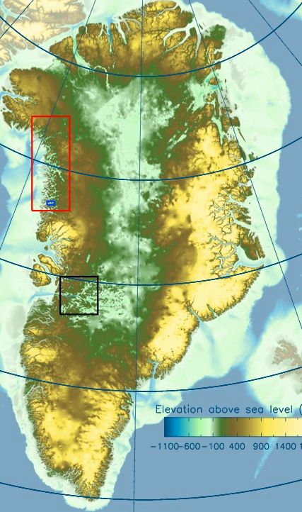
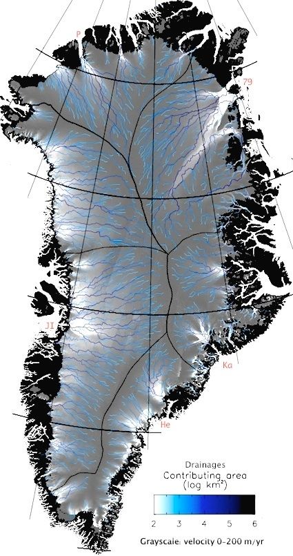
A-Team's comment on Neven's blog showing topography of Greenland, under the ice sheet
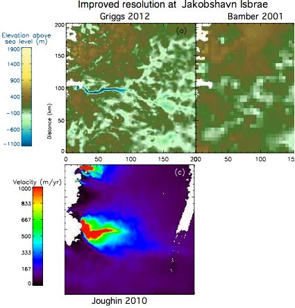
Still playing catch-up here. Several people have asked if the bedrock map of Greenland has been updated since Bamber 2001. Yes indeed, Griggs 2013 will appear next week in final form, free full text below.
The interior area below sea level has been corrected to 22% but consider too actual track coverage the error map (Fig.7). Much, but not all, of this is warmed by the (highly variable) geothermal gradient to a temperature where the pressure from above does not allow ice.
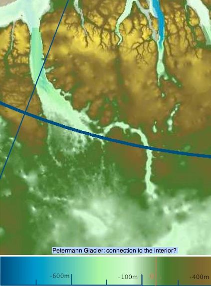
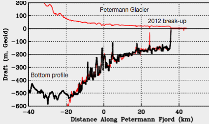
The resolution is immensely better in near-coastal regions (below, for Jakobshavn Isbrae). I enlarged Petermann glacier to the max (also below). With Petermann, the interest is in the main sill, secondary sills if any, currents cutting channels in the underside, the nature of the grounding line (gravelly sediment or precambrian bedrock), fjord overdeeping behind the hinge, and the connection if any to the main below-sea level interior. These issues are still not fully resolved even by dedicated flights; a submarine visit in the works next season could resolve down-fjord issues.
I just have to wonder what happens when the Petermann melts back enough for ocean water to get past the grounding line and connect with this large and deep pool of water, which may be augmented shortly by moulin drainage from higher elevation melt ponds (which are perfectly capable of drilling a couple of km straight down). A giant floating ice cube?
While this is an excellent article in many respects, the cartography products are unsatisfactory (as they often are in climate science). The color palettes are terrible, layers were flattened in the wrong sequence, no kmz, and nothing useful is supplied in supplemental -- not even the core map at measurement resolution. Do we need lat/long lines masking data? -- surely readers of The Cryosphere know where Greenland is located. Evidently 10k readers have to purchase 10k copies of mapping software, dive into yet another raw data format 10k times, guess at the projection, and produce the map that reviewers should have required in the first place. Then go through it all again with some other layer they need to co-register. GIS = geographical information system.


