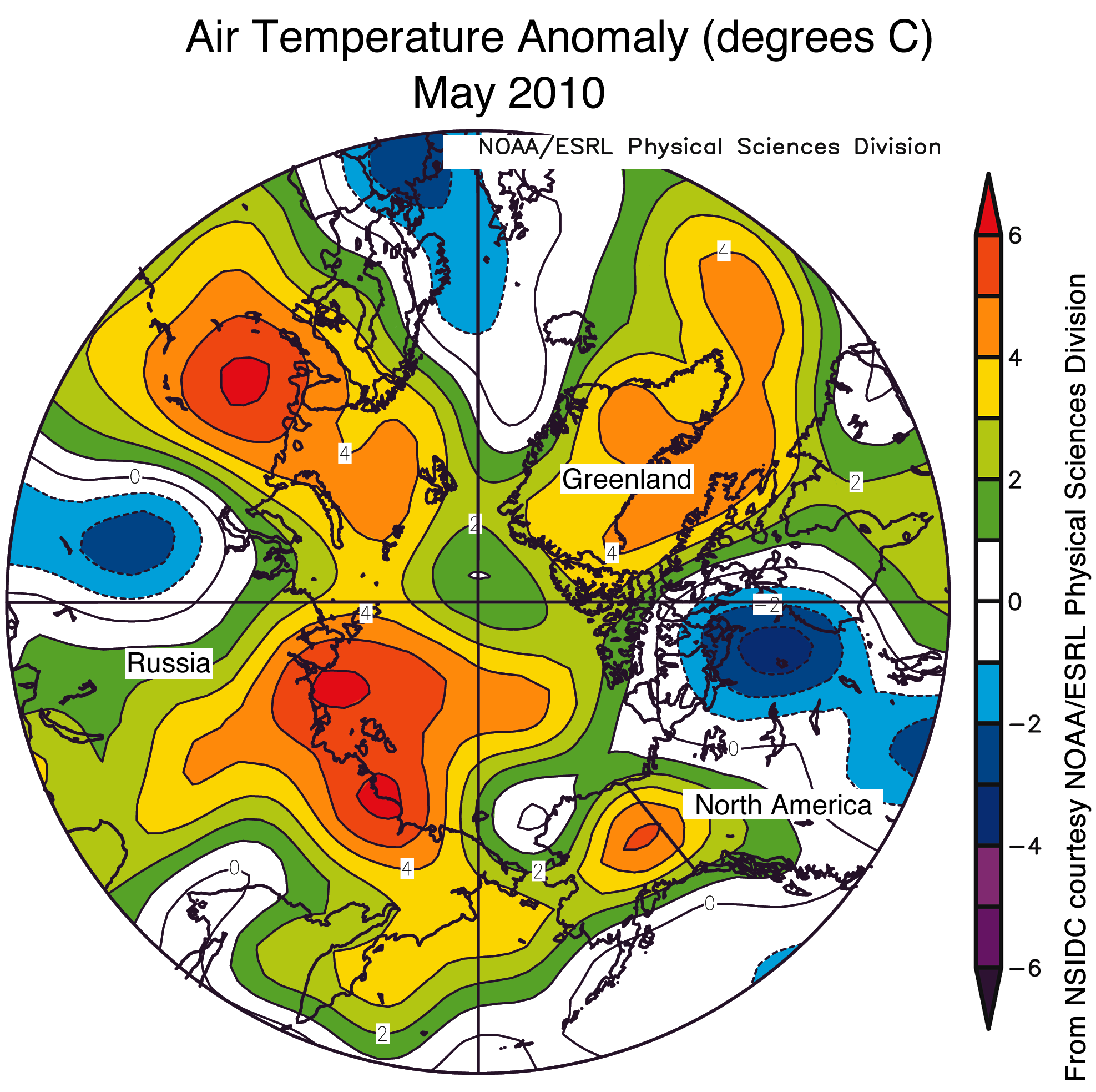
Figure 4. This map of air temperature anomalies for May 2010, at the 925 millibar level (roughly 1,000 meters or 3,000 feet above the surface), shows warmer-than-usual conditions over much of the Arctic Ocean, especially along coastal Siberia. Areas in orange and red correspond to positive (warm) anomalies. Areas in blue and purple correspond to negative (cool) anomalies. —Credit: National Snow and Ice Data Center courtesy NOAA/ESRL Physical Sciences Division
Persistent warmth in the Arctic
Arctic air temperatures averaged for May were above normal, continuing the temperature trend that has persisted since last winter. Temperatures were 2 to 5 degrees Celsius (4 to 9 degrees Fahrenheit) above average across much of the Arctic Ocean. A strong anticyclone centered over the Beaufort Sea produced southerly winds along the shores of Siberia (in the Laptev and East Siberian seas), resulting in warmer-than-average temperatures in this area. The Canadian Arctic Islands were an exception to the general trend, with temperatures slightly cooler than average over much of the region.

Link: http://nsidc.org/arcticseaicenews/


No comments:
Post a Comment