
Images from near-Earth orbit help us with everything from weather forecasting and disaster management to archeology.

What are the primary forces behind what we call weather, and how does El Niño take over the global weather system?

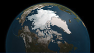
View satellite images of glaciers that have wreaked havoc—or might soon.

What exactly is this high, eastward-flowing wind we hear about on weather reports? Find out in this interactive.

In this audio slide show, examine the link between rising sea surface temperature and more intense storms.

Twin satellites probing the Earth's radiation belts return the clearest recordings yet of a "chorus" of radio waves.

Why climate change is making hurricanes more dangerous.
A climate scientist suggests that rapid warming in the Arctic helped create October's "superstorm."

Your average hurricane releases enough energy to power the world 200 times over. Go figure.

Journey back to the beginning of everything: the universe, Earth and life itself.

Research solar storms using images from NASA telescopes; share your work; and find out about careers in science.


No comments:
Post a Comment