Arctic Sea Ice hits a record low for this time of year
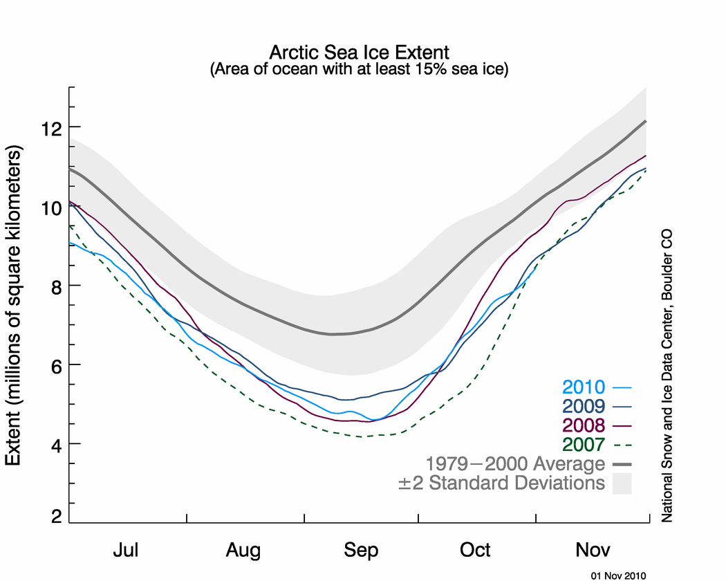
Figure 2. The graph above shows daily Arctic sea ice extent as of November 1, 2010, along with daily ice extents for years with the previous four lowest minimum extents. Light blue indicates 2010, dark blue shows 2009, purple shows 2008, dotted green indicates 2007, and dark gray shows the 1979 to 2000 average. The gray area around the average line shows the two standard deviation range of the data. Sea Ice Index data. —Credit: National Snow and Ice Data Center
Conditions in context:
Following the minimum ice extent on September 19, 2010, the ice cover quickly expanded as polar darkness returned to the Arctic and air temperatures dropped. Ice grew at an average daily rate for the month of October of 92,700 kilometers per day (35,800 square miles per day). This was similar to the growth rate in 2009, but slower than the growth rate following the 2007 and 2008 minimum ice extents. It was slightly faster than the 1979 to 2000 average rate of 82,200 square kilometers (31,700 square miles) per day.
At the end of October, ice growth slowed, and at the end of the month extensive open water areas remained in the Beaufort, Chukchi, Kara and Barents Seas. This region had the warmest ocean surface temperatures at the end of the melt season.
Link: http://nsidc.org/arcticseaicenews/


No comments:
Post a Comment