Arctic sea ice appears to have broken the 2007 record daily extent and is now the lowest in the satellite era. With two to three more weeks left in the melt season, sea ice continues to track below 2007 daily extents.
Please note that this is not an announcement of the sea ice minimum extent for 2012. NSIDC will release numbers for the 2012 daily minimum extent when it occurs. A full analysis of the melt season will be published in early October, once monthly data are available for September.
Overview of conditions
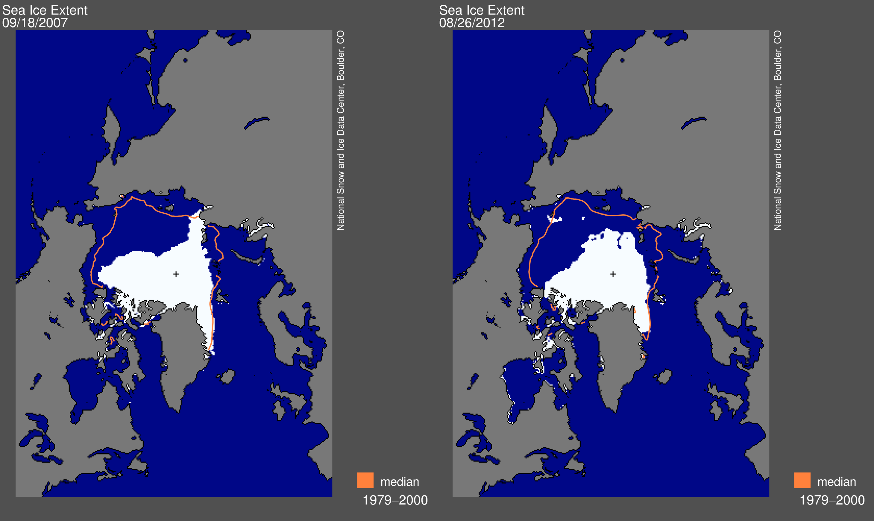
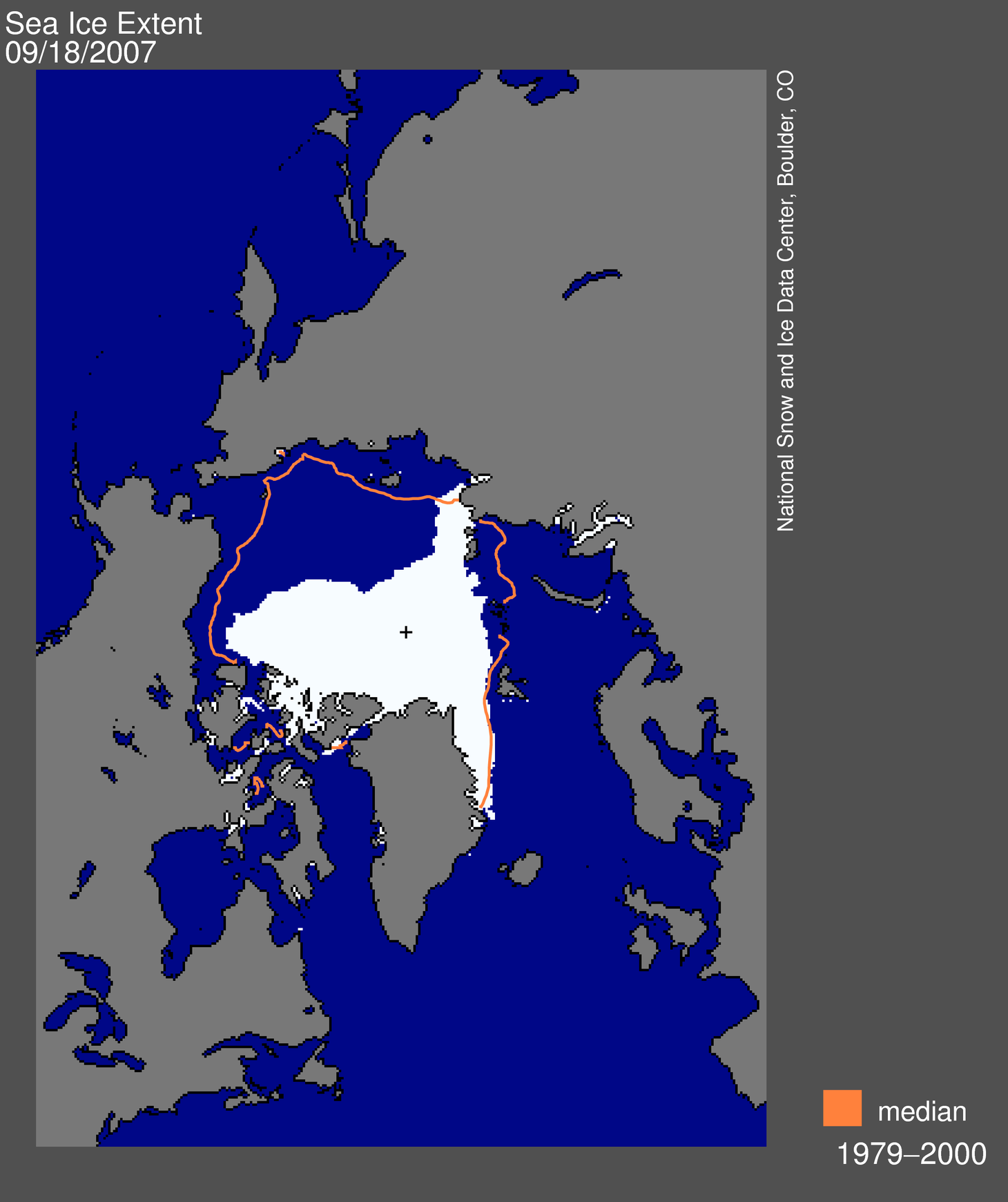
Figure 1. Arctic sea ice extent for August 26, 2012 (right) was 4.10 million square kilometers (1.58 million square miles), which was 70,000 square kilometers (27,000 square miles) below the September 18, 2007 daily extent of 4.17 million square kilometers (1.61 million square miles, left). The orange line shows the 1979 to 2000 median extent for that day. The black cross indicates the geographic North Pole. Sea Ice Index data. About the data. Credit: National Snow and Ice Data Center. High-resolution images: Figure 1a , Figure 1b
Arctic sea ice extent fell to 4.10 million square kilometers (1.58 million square miles) on August 26, 2012. This was 70,000 square kilometers (27,000 square miles) below the September 18, 2007 daily extent of 4.17 million square kilometers (1.61 million square miles).
Including this year, the six lowest ice extents in the satellite record have occurred in the last six years (2007 to 2012).
Conditions in context
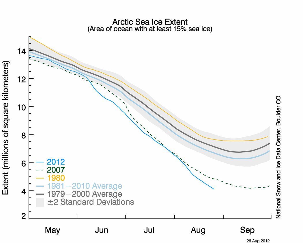
Figure 2. The graph above shows Arctic sea ice extent as of August 26, 2012, along with daily ice extent data for 2007, the previous record low year, and 1980, the record high year. 2012 is shown in blue, 2007 in green, and 1980 in orange. The 1979 to 2000 average is in dark gray. The gray area around this average line shows the two standard deviation range of the data. The 1981 to 2010 average is in sky blue. Sea Ice Index data. Credit: National Snow and Ice Data Center.
High-resolution image
High-resolution image
After tracking near 2007 levels through July, the extent declined rapidly in early August. Since then, the loss rate has slowed some, averaging about 75,000 square kilometers (29,000 square miles) per day—equivalent to the size of the state of South Carolina. However, this is still much faster than the normal rate at this time of year of about 40,000 square kilometers per day (15,000 square miles).
Note that the date and extent of the 2007 minimum have changed since we originally posted in 2007; see our Frequently Asked Questions for more information.


No comments:
Post a Comment