Warm periods are bringing the temperature up by as much as 30 C in the middle of winter
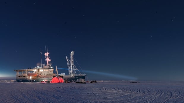
The research vessel Lance sits in the Arctic sea ice on 17 February 2015. (Courtesy Paul Dodd/Norwegian Polar Institute)
by Jimmy Thomson, CBC News, July 12, 2017
Extreme warming events are blowing into the Arctic more frequently during the winter, and lasting longer, according to a new study from the American Geophysical Union. The storms have an effect on sea ice formation, and could even be linked to extreme weather in the south.
"The big takeaway for us was that these seemingly unbelievable winter temperatures close to the North Pole, close to 0 C, is not completely new — but in recent years, these patterns are increasing, and we're getting more of these storms," says lead author Dr. Robert Graham, of the Norwegian Polar Institute.
Normally, during the winter, temperatures in the High Arctic stay below –30 C. But, occasionally, a storm blows in from the Atlantic or Pacific Oceans, bringing warm air with it. The resulting extreme weather contributes to melting sea ice through high temperatures and accompanying high winds.
But the effects also last beyond the event itself. By adding snow that insulates the ice from the returning cold temperatures, the storms also prevent the ice from refreezing.
"In 2017, we had the record minimum sea ice extent in March. So these two things, we believe, are going hand in hand," says Graham.
Sea ice disappearing
A lack of sea ice can cause its own problems. Open water absorbs more heat than ice, so the ocean warms even faster. That, in turn, makes it more difficult for the ice to form the following year, causing a cascade of ecological effects throughout food webs.
Warming events have been recorded as far back as 1893, when explorer Fridtjof Nansen's Fram expedition spent four years drifting in the Arctic Ocean. During that trip, the crew recorded temperatures as high as –3.7 C in March, at 84 degrees north.
For this study, the authors also drew on half a century worth of data from drifting Soviet research stations on the polar ice, which, in 1956, recorded the first winter temperatures above –1 C at 85 degrees north.

A 'snow buoy' embedded in the sea ice takes temperature readings.
More recent data came from modern sea ice buoys.
Over the last century of data, the researchers found high temperatures were increasingly common, and increasingly long. The average length of a warm period around the North Pole has increased by 4.25 days each decade since 1980, and Graham expects the trend to continue to intensify in the future.
Some scientists have argued that the lack of sea ice has destabilized the jet stream, leading to cold weather sweeping south while warm southern weather pushes further north, meaning that strange winter events in the south, like ice storms in Texas and a persistent "blob" of warm water in the Pacific, may be related to the conditions in the Arctic.
"I think that this is kind of what we expect," says Graham, but cautions that that is not within the scope of the current study.
"It's something we want to look into in the future."


No comments:
Post a Comment