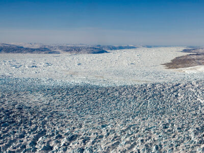
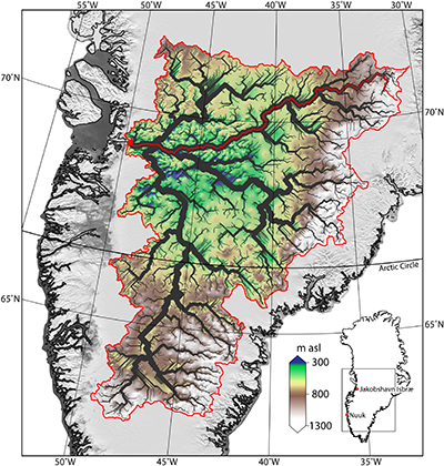
An ancient drainage basin covering one fifth of Greenland predates the ice sheet and strongly influences the modern Jakobshavn Glacier, according to a new analysis of ice-penetrating radar data.

Using detailed geophysical surveys of Greenland and Antarctica conducted during the past few decades, scientists can now peer below the thick glacial ice to learn more about the origin and evolution of the underlying landscape. To date, most of these studies of subglacial topography have focused on Antarctica. Now Cooper et al. have turned their attention to Greenland, where they have discovered the first evidence of an extensive network of rivers in the landscape beneath the Jakobshavn Isbræ, the island’s largest outlet glacier.
Using a digital elevation model generated from ice-penetrating radar data and corrected for the weight of the modern ice sheet, the team charted the ancient river network using two different software packages. The results of both tools reveal a dendritic network of valleys radiating inland from the Jakobshavn Glacier —a landscape that, according to the researchers, covers an area comparable in size to the Ohio River Basin and predates the formation of the ice sheet about 3.5 million years ago.

Assuming a steady rate of incision into the hard, underlying gneiss, the researchers estimate that it would have taken about 2.3 million years to carve the observed channels, although they acknowledge that processes like glacial outbursts or increased discharge during interglacial periods could have shaped them over much shorter periods of time.
Near the basin outlet, the researchers also observed an abrupt break in slope at the confluence of three ancient channels. This knickpoint coincides with the location where the surface flow of the Jakobshavn Glacier rapidly accelerates, a finding that suggests that the underlying, preglacial landscape exerts a strong influence on the location, shape, and size of Greenland’s largest outlet glacier.
(Geophysical Research Letters, doi:10.1002/2016GL069458, 2016)
—Terri Cook, Freelance Writer
Citation: Cook, T. (2016). A river network preserved beneath the Greenland ice sheet, Eos, 97, doi: 10.1029/2016EO054839. Published on 28 June 2016.
Really great article.. amazing to compare that with new surface views of the same area in maps.google.com .... they seem to have much better views... low albedo shows rivers that appear 50 feet wide. Strong contrast details up ice from Kangerlussuaq - great detail
ReplyDelete